Veracity for Class Maritime Portal
Map view
The map view shows your fleet on a world map. Click on a vessel's name or symbol to open its details pane. The vessel's destination port is then highlighted on the map.
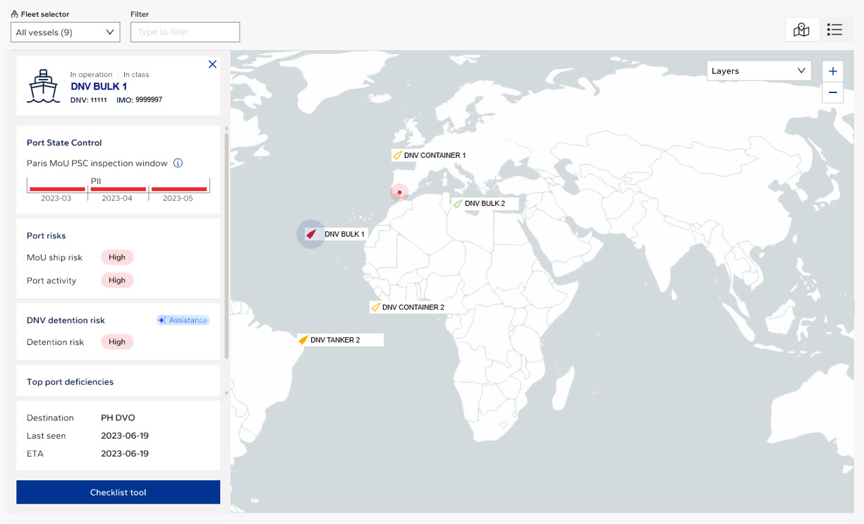
Each vessel is colored according to a combination of its PSC inspection window at the destination and its DNV detention risk, so you can see immediately where attention is needed.
|
Color |
When it is shown |
|
Red |
The detention risk is High and the vessel is within its inspection window (PI or PII), or no inspection window can be calculated for the destination. These vessels should be prepared with priority. |
|
Yellow |
The vessel is within its inspection window (PI or PII) and the detention risk is Standard, or the detention risk is Standard and no inspection window can be calculated. A vessel in Priority I without a detention risk calculation is also shown in yellow. |
|
White |
The vessel is not due for inspection at its destination, or neither rating can be calculated. A vessel that was recently inspected in the MoU region (within the last 12 months with Standard detention risk, or within the last 6 months with High detention risk) is also shown in white when no inspection window can be calculated. |
The details pane brings together everything you need for the vessel's next port call:
· The selected vessel with its AIS status, DNV ID and IMO number.
· Port State Control: the MoU of the current destination and the vessel's PSC inspection window in that MoU.
· Port risks: the MoU ship risk and the port activity of the destination port.
· DNV detention risk: the vessel's detention risk rating. Hover over the rating to see the main contributing factors.
· Top port deficiencies: the deficiency areas most often recorded on vessels of the same type in the AIS destination port, for example Fire safety, Life saving appliances, Safety of navigation, ISM or MLC, 2006.
· The AIS destination, when the vessel was last seen, and its ETA.
· A Checklist tool button for direct access to the vessel's checklist tool.
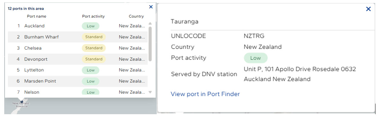
Ports are shown as markers on the map. Depending on the zoom level, ports close to each other are combined into a single marker. Clicking such a marker lists the ports in the area with their name, port activity and country. Zoom in to see the exact position of each port; once a marker represents a single port, clicking it shows more details about that port.
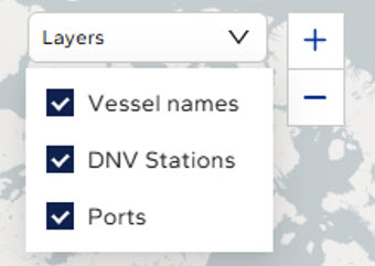
Use the Layers menu at the top right of the map to choose what is displayed:
· Vessel names: shows the vessel names next to their symbols. This layer is on by default; when it is switched off, only the vessel symbols are shown.
· DNV stations: shows the locations of DNV stations. Click a station marker to see its location and contact details. Stations close to each other may be combined into one marker.
· Ports: shows the port markers described above.